The Unique Maps Co.
Old Map of Chico, California by USGS, 1912 – Durham, Feather River & Aguas Frias
Old Map of Chico, California by USGS, 1912 – Durham, Feather River & Aguas Frias
Couldn't load pickup availability
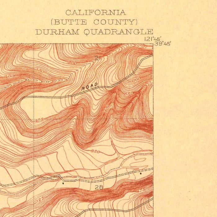
Titled “Durham,” this 1912 U.S. Geological Survey topographical map presents a finely observed portrait of Chico, Durham, and the surrounding Butte County landscape at the revealing scale of 1:31,680. Created during an era when California’s interior valleys were being measured, irrigated, cultivated, and connected with increasing precision, the map captures a moment before later suburban expansion reshaped the region. Chico appears as the principal populated center, set within a matrix of roads, railways, fields, waterways, and smaller settlements. The title itself reflects the USGS quadrangle tradition, in which local place names anchored systematic surveys of the American landscape. Here, “Durham” becomes more than a label: it is a window into northern California’s agricultural geography in the early twentieth century.
The U.S. Geological Survey, founded in 1879, brought scientific rigor and national ambition to the mapping of America’s terrain, minerals, water systems, and settlement patterns. This map belongs to that great project of observation: a careful synthesis of elevation, drainage, transportation, and habitation. By 1912, the USGS had become indispensable to engineers, landowners, planners, and natural resource specialists, offering maps that were both practical tools and elegant records of place. The Durham sheet reflects the Survey’s characteristic clarity, with measured linework and disciplined symbology transforming a complex rural landscape into a legible, authoritative composition. It records not only where communities stood, but how they related to landform, water, routeways, and productive agricultural ground.
Chico, the most prominent urban presence on the map, appears at a fascinating stage in its development. Known for its fertile surroundings, tree-lined streets, and proximity to both valley agriculture and foothill landscapes, Chico served as a commercial and civic hub for the northern Sacramento Valley. Around it, the map shows smaller communities and localities such as Durham, Aguas Frias, Esquon, and Rancheria, each embedded in a pattern of roads, rail connections, and cultivated parcels. These names evoke the layered history of the region: ranching, farming, transportation, settlement, and the long transformation of indigenous and Mexican-era landscapes into surveyed American townships. The result is a richly textured view of place before modern growth blurred many of these early distinctions.
The cartographic design is especially appealing for its topographical language. Contour lines trace the shape of the land, giving visual form to subtle rises, drainage corridors, and the broader transition between valley floor and surrounding terrain. Hachuring and carefully rendered elevation details add depth and movement, allowing the viewer to perceive the physical character of the countryside rather than merely its roads and towns. The Feather River and associated waterways help organize the map’s geography, underscoring the importance of water in a region defined by agriculture, seasonal flow, and irrigation potential. Railways and roads cut through this natural framework, revealing the infrastructure that connected farms, markets, mills, and communities in early twentieth-century Butte County.
As a historical document, the map is particularly valuable for the way it preserves land use and development patterns from 1912. Agricultural fields, settlement clusters, transport lines, and named localities speak to a landscape still dominated by rural production, long before the expansion of modern Chico and the reshaping of regional transportation networks. The area’s later growth makes this earlier configuration all the more compelling: roads that were once local arteries, fields that marked the economic life of the valley, and communities that occupied distinct positions in the rural order can be studied in their original spatial relationships. Elegant, exacting, and quietly evocative, the Durham map offers both scientific precision and a richly historical view of northern California.
Cities, towns and places on this map
- Chico
- Durham
- Aguas Frias
- Esquon
- Rancheria
- Feather River
- Various roads and railways in the vicinity
- Nearby agricultural fields and landmarks
Historical context & cartographic details
- Produced by the U.S. Geological Survey in 1912
- Historical topographical map at a scale of 1:31,680
- Uses hachures to depict elevation changes and terrain relief
- Features contour lines showing elevation and landform shape
- Reflects early 20th-century land use and development patterns
- Shows a landscape shaped by agriculture, transportation routes, and natural features
- Provides insight into how the region’s layout has changed through urban expansion and agricultural development
Looking for a particular place? Review the detailed images to confirm that the town, landmark or feature you have in mind appears on the map. If you are unsure, ask our workshop to check before you order.
Detailed maps are especially rewarding at larger sizes, where names, boundaries and decorative features have more room to be appreciated. Use the close-up preview and size guide to choose the right scale for your wall.
This map looks amazing at sizes all the way up to 50in (125cm). If you are looking for a larger map, please get in touch.
The model in the listing images is holding the 16x20in (40x50cm) version of this map.
Where personalisation is available, you can add a short title or dedication, mark one meaningful place, or request one considered visual detail. See personalised map examples.
Every piece is printed to museum-grade archival standards using fade-resistant pigment inks on acid-free matte paper. Choose an unframed map print, framed map or canvas using the finish options above. Framed maps use crystal-clear optical acrylic and arrive ready to hang.
With its rich detail and strong sense of place, this map makes a considered gift for a new home, anniversary, retirement or anyone with a personal connection to the area shown. Still deciding? Explore our collection of rare old and vintage maps to discover another place, period or style.
Share